Standing tall and spanning west to east across Alaska’s rugged Arctic region is the Brooks Range.
The Brooks Range is best known for the hundreds of thousands of caribou that pass through this area of the Alaska Range in massive migratory herds. These Alaska mountains are home to a handful of spectacular peaks that range from 8,000-9,000-feet tall as well as long stretches of surrounding tundra that make for perfect camping and sightseeing areas. These features make the Brooks Range a popular destination for the most hardcore outdoor adventurers who crave challenging mountaineering, hiking and rafting.
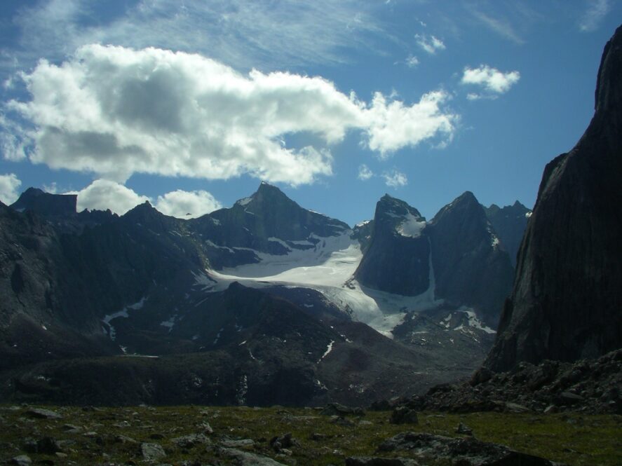
Arrigetch Peaks Glacier in the Brooks Range (NPS)
While the Brooks Range covers some of Alaska’s coldest and most isolated and intense terrain, the traces of human activity here are notable. The Trans Alaska Pipeline System and Dalton Highway (or Haul Road) traverse north-south through the range connecting the oil-busy North Slope to Fairbanks and beyond (the road’s elevation peaks at Atigun Pass, elevation ~4,700 feet); the Red Dog Mine, set in the western part of Brooks Range, is the world’s largest zinc mine; and the tiny community of Coldfoot, just north of the Arctic Circle, is pretty much the last-chance-for-gas, food and a warm bed for most travelers heading north until they clear the Range and reach Prudhoe Bay and Deadhorse.
A few fun facts about Alaska’s Brooks Range:
- The Brooks Range was named after longtime Alaskan geologist Alfred Brooks
- The mountains of the Brooks Range travel through numerous Alaska national parks and refuges
- This mountain range is technically an extension of the Rocky Mountains